4
habitat blocks
Habitat fragmentation
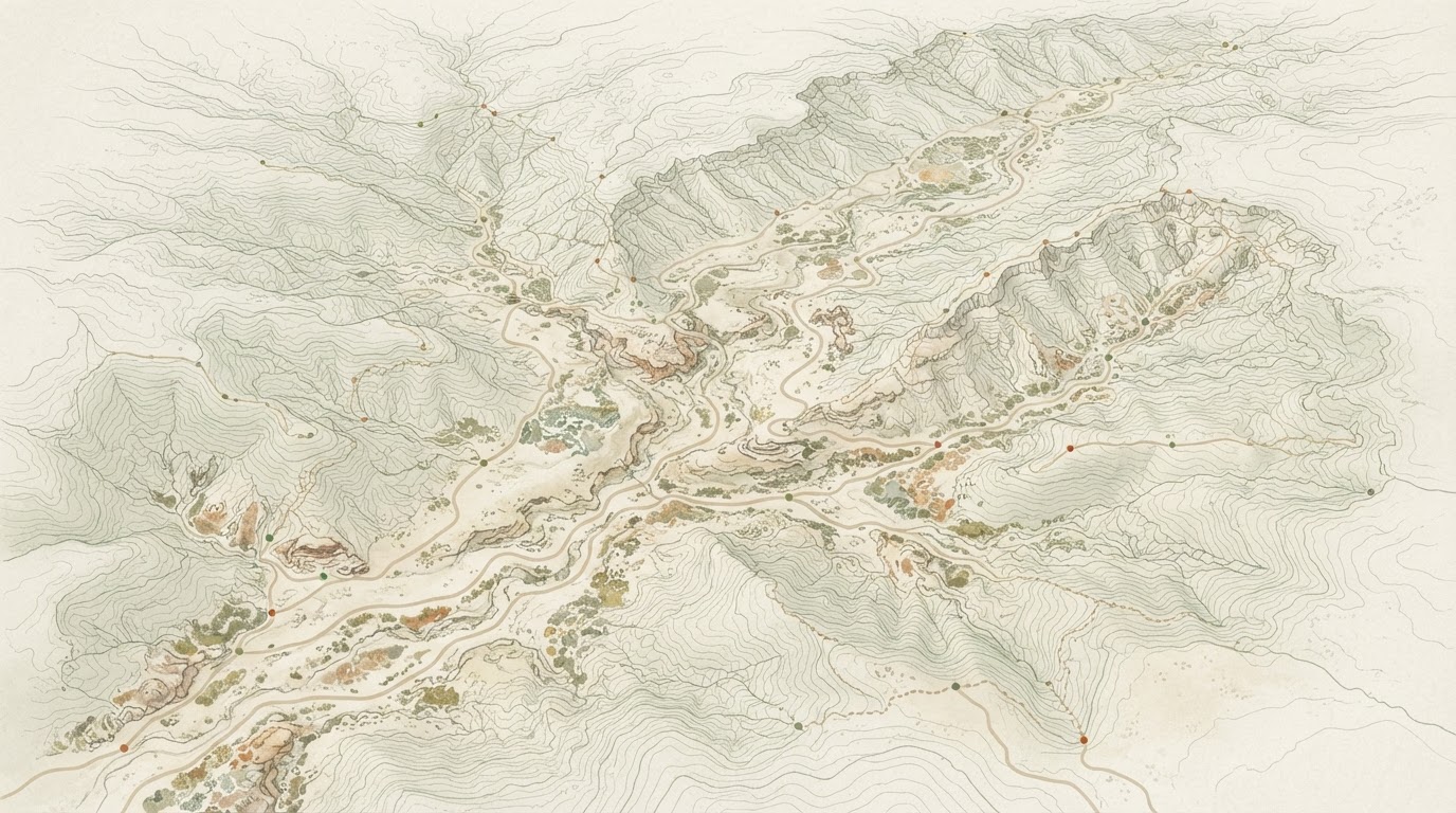
Existing development and the road network have divided the valley's habitat into four large blocks. Creosote Wash is the only continuous link between them, and Saddleback Road cuts it in two places.
Area Plan
Growth • Biodiversity • Connectivity
Planning for a growing community while protecting the systems that connect people, places and habitat.
Draft Plan Review · Public review open through November 15Demonstration project · demonstration data
Creosote Valley 2045 is an illustrative planning project created to demonstrate Tortoise 40. Places, findings, public input, and project data shown here are fictional or demonstration content unless otherwise identified.
References to planning workflows, public agencies, or government processes do not imply endorsement by any particular public agency. Trust + Transparency
Pass it on
Share the project with someone who should see it.
Stay with it
Follow the project for what comes next.
Take it away
The whole project, as a document you can send on.
Project schedule
The project is in phase 04, Draft Plan Review. Six phases from existing conditions to adoption. Dates are indicative and would be confirmed by the lead agency.
Why this plan matters
268,400
Residents
101,200
Households
32,000
Planning area acres
34%
Projected growth by 2045
Creosote Valley is growing. Over the next two decades, new neighborhoods, roads, parks, trails, community facilities and employment areas will shape how people experience the valley.
At the same time, Creosote Valley contains important desert habitat, wildlife movement areas, washes, open space and natural landscapes.
The Creosote Valley 2045 Area Plan explores how these systems can work together. It will guide future growth while protecting important natural areas, improving ecological and human connectivity, expanding access to parks and trails, and creating a more connected and resilient community.
Creosote Valley · Planning Area
Illustrative pattern, not a survey.
Point at a feature to trace it · choose it to hold it
Creosote Wash is the only continuous link between the four habitat blocks.
Community profile
Creosote Valley 2045 plans for 268,400 residents in 101,200 households. Understanding them means reading three sources together: the public record, what residents tell us when they register, and what participants have said. Each is kept to its own strength, and where a field has no verified figure the profile says so rather than filling it in.
A valley of 101,200 households, projected to grow about 34 percent by 2045. Growth is expected to concentrate in the three areas that already have streets, water and services.
Households by district
Population and household counts are the baseline every other figure in this profile is read against.
Population, age, households, income, work, language
Drawn from the Census, so it describes the whole valley rather than the people who happened to answer.
3,184 registered · 1,306 shared demographics
What residents tell us when they register. The only source that can reach the fields the Census does not ask.
6,128 pieces of input
Surveys, map comments and polls. Rich on how people use the valley, honest only about those who took part.
34%
Projected growth by 2045
3,400
Growth acres directed
3
Growth areas
14,600
Habitat acres held
Growth pressure
That demand has to land somewhere. The plan directs it to the three locations that already have streets, water and services, and holds the valley edges out of the development framework.
Town Center & Main Street
Mixed use, smaller commercial spaces, and housing above.
Saddleback Road Corridor
Consolidated commercial frontage with safer crossings.
Cholla Heights Edge
Limited residential where it meets the habitat corridor.
Development capacity
Housing units
unitsMeets the 2045 demand of 135,600 units
Jobs
jobsMeets the 2045 demand of 106,200 jobs
Park acres
acres7% below the 2045 demand of 8,200 acres
Trail miles
miles14% below the 2045 demand of 394 miles
Each track runs to the 2045 demand for that measure. Housing and jobs are met within the three growth areas, without expanding the planning boundary into intact habitat. Park acreage and trail mileage stay short of what the 2045 population needs, which Chapters 5 and 6 address. Figures are demonstration values.
Opportunities + Challenges
Each item leads with its takeaway, marked in the headline, with the evidence behind it underneath.
Opportunities
04One corridor already does two jobs
Creosote Wash carries the valley's drainage and its only continuous habitat link, so protecting it serves both.
Growth can go where the infrastructure already is
The Town Center and Main Street can absorb substantial growth without new roads, water or sewer.
The corridor is fundable and within reach
Habitat restoration along the wash is grant eligible, and the corridor crosses few ownerships.
Two crossings, one fix
The wash crossing and the school crossing are the same problem seen from two directions, so one project answers both.
The plan can build on systems the valley already has.
Challenges
04The trail network has 54 miles of gaps
Missing connections are concentrated at Creosote Wash and the Cholla Heights edge.
Saddleback Road splits the habitat corridor in two
Wildlife movement and vehicle crashes overlap at the same two points.
Park access is uneven across the valley
The southern districts sit outside a ten-minute walk of a park.
Housing costs are outrunning local wages
Rents and prices are rising faster than local wages, and the street network has gaps.
The gaps are specific, located and measurable.
118
Pages in the draft
9
Chapters
v4
Document version
Oct 1 – Nov 15
Open for comment
Draft plan overview
118 pages across 9 chapters, published for public review on September 28, 2026. The central question is how the valley should grow while protecting the landscape that makes it unique.
This draft answers it by directing growth to three areas that already have infrastructure, and by treating habitat, washes and wildlife movement as systems the plan has to keep connected.
How the draft was built
Every recommendation traces to a documented condition, a stated community priority, or both. Where the two disagree, the plan says so.
The document, chapter by chapter
118 pagesKey takeaways
4
habitat blocks
Habitat fragmentation
Existing development and the road network have divided the valley's habitat into four large blocks. Creosote Wash is the only continuous link between them, and Saddleback Road cuts it in two places.
2
critical crossings
Wildlife movement
Documented movement concentrates along the wash corridor and the northern slopes. Two crossings account for most of the recorded barrier effect, and both are addressed in the recommendations.
54
miles missing
Trail connectivity
286 miles of trail exist, built largely through subdivision approvals, with 54 miles of missing connections between segments. Creosote Wash and the Cholla Heights edge hold the two largest gaps.
3
growth areas
Growth capacity
The Town Center, the Saddleback Road corridor and the Cholla Heights edge can accommodate projected demand through 2045 without expanding the planning boundary into intact habitat.
6,200
acres of park
Park access
6,200 acres of public park land sit unevenly across the valley. Residents in the northern districts are within a ten-minute walk of a park; the southern districts are not.
1
priority crossing
Street safety
Reported near misses concentrate at the Middle School crossing on Saddleback Road. That location leads the safety program.
Plan Themes
Growth, biodiversity and connectivity are the three systems the plan holds together. Every recommendation in the draft answers to one of these themes.
Grow
Guide development to locations that already have streets, water and services.
Connect
Link neighborhoods, schools, parks and trails for people moving through the valley.
Protect
Keep habitat, washes and wildlife movement areas connected and intact.
Explore
Expand access to parks, trails, open space and the desert around them.
Thrive
Build a resilient community where growth and natural systems support each other.
Review the draft plan
Selected draft plan pages — 12 of 118 — with 190 comments on record. Click anywhere on a page to place a numbered comment marker, or add a page comment without placing a marker. No account required.
Cover
Vision & Context · Draft page 1
Public Review Draft · September 2026
Area Plan
Growth • Biodiversity • Connectivity
Prepared by the Creosote Valley Planning Department. This is a fictional demonstration document, produced to illustrate how a public review draft is organized and reviewed.
Comment period · October 1, 2026 – November 15, 2026
Sample page 1 of 12 · Draft page 1 · pinch to zoom, swipe to turn the page, or turn on comment mode to leave one.turn on comment mode to place a comment.
Themes and concerns drawn from every comment on this draft. A reading aid, not a finding.
Comments on page 1
1Taylor Young
Connectivity
The plan should show trail ownership and who maintains each segment.
190 comments on this document · 118 pages
The program
Sep 2024 – Jun 2027Six phases, from the first field season to adoption, with every engagement activity the project has run plotted against them. Everything left of the line has happened. Everything right of it is committed to, but not yet done.
The process, in numbers
September 2024 to today38
Engagement events
Workshops, open houses, pop-ups, briefings and hearings.
9
Open houses & pop-ups
In person at the Community Center, and online.
34
Stakeholder meetings
Agencies, utilities, tribes and community groups.
62
Meeting minutes recorded
Published with the project record, unedited.
3
Draft plans issued
Draft 1, Draft 2 and the public review draft.
46
Social media blasts
Project announcements and explainers.
3
Comment periods
Each one summarised by question, in full.
5
Technical memoranda
Filed alongside the plan and open to read.
Counts cover the project to date. Meeting minutes and technical memoranda are published in full with the project record; nothing is summarised in their place.
How we got here
7 of 11 milestones completeExisting conditions initiated
Baseline field work, habitat mapping and the first trail inventory.
Community visioning complete
Three workshops and the guiding principles that frame the plan.
First community survey released
Responses gathered on growth, habitat and trail priorities.
Open space & connectivity workshop
Field session along Creosote Wash with map boards at Saddleback Trailhead.
Community survey results released
Results published by question, with every open response kept in full.
Growth alternatives released
Three alternatives published for public comment.
Preferred framework selected
The balanced framework carries forward into the draft plan.
Draft Area Plan released
Public review draft published. Comment on any page of the document.
Public review period closes
Every comment recorded against its page, place or question.
Planning Commission review
Revised draft and the full participation record.
Board adoption
Final Creosote Valley 2045 Area Plan adopted.
Public review period
October 1 to November 15, 2026
Open to everyone. Everything received is published in the comment log, unedited.
5days remaining
Past updates
5 publishedThe Draft Creosote Valley 2045 Area Plan is published for public review. Comment on any page of the document, mark the map, or take the community survey. The review period runs through November 15.
Creosote Valley Planning Department
A community workshop on the draft Area Plan is scheduled for October 15 at the Creosote Valley Community Center, with stations for the plan, the habitat map and the community survey.
Creosote Valley Planning Department
The preferred framework was presented to the Planning Commission. It integrates the three growth areas with a connected habitat, open-space, trail and mobility network, and carries forward into the draft plan.
Creosote Valley Planning Department
Participation at a glance
See what people shared during the public review period, and how that input is informing the plan.
3,184 people took part, leaving 6,128 pieces of input across the review.
Point at a figure to see what it countsCumulative participation across the project. These measures overlap — a resident who took the survey and also commented on the map is counted in both — so they do not add up to a single total.
Bars compare each figure against the largest shown.
Most often raised
Participants most often raised the connection between Creosote Wash and the larger habitat areas around it, and asked how new development would affect wildlife movement across Saddleback Road.
684
comments on this theme
27% of every theme raised
What the draft does about it
Draft Recommendation B-01 is being reviewed to determine whether the proposed habitat corridor should be widened along the western edge of the Cholla Heights growth area.
Demonstration content only. Staff make planning decisions. Theme analysis is a reading aid, not a recommendation.
Participation Over Time
The draft plan review period opened October 1. Figures shown are cumulative across the project.
Community Priorities
2,447 responses · single selection
What Creosote Valley should prioritize
2,447 responses · multiple selections allowed
Map Feedback
Every comment placed on the map, read on the same drawing the plan is prepared on. Choose a topic to narrow the list; the numbered marks on the sheet answer to it.
Marks are sized by how much comment each place carries, and numbered against the list beside them. Concentration is a reading aid, not a statistically representative sample.
The places holding the most comments during the review period.
Results in Detail
The poll, the map comments, the survey and the draft plan, read side by side. Each figure carries its own total and its own note.
One answer each. The poll stays open through the review period.
Selected Participant Comments
Six comments from the review, each one shown with the chapter and page of the draft it was made against. The spotlight turns on its own; choose any comment to hold it.
"The trail stops on both sides of Creosote Wash. A crossing there would link two neighborhoods to the middle school in under ten minutes."
Dana Whitfield
Key Themes
Comments and survey responses, grouped by the subject they address. Themes are a reading aid, not an adopted priority.
Step 01 of 5
15 Nov 2026
Every comment received is published in the comment log, unedited.
Dates are indicative. Adoption follows Planning Commission review and any revisions the comments require.
The full record
Nothing above this point is a summary of the record, and nothing here is either. Read every comment in full, each one with the page of the draft it was made against.
Stay updated on this project
Follow this project from a Tortoise account.
A free account saves Creosote Valley 2045 to your dashboard, so you can find it again and catch up on what it publishes. Tortoise does not send update emails yet, and taking part never needs an account.
